Actualizado el 26/06/2026
Actualizado el 26/06/2026
The GHGSat team use their satellites to spot methane plumesEscrito por Redacción TNI el 23/11/2021 a las 22:03:291335
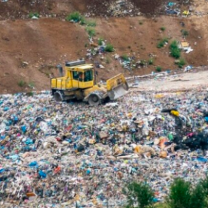 The area was originally identified based on methane hotspot mapping using Tropomi data from the Copernicus Sentinel-5P satellite by researchers at SRON. The GHGSat team then used their satellites to spot methane plumes on 20 August and 13 October 2021, emanating from two landfill sites approximately six km apart, located just 18 km from the centre of Madrid.
The largest source released methane at a rate nearing 5000 kg per hour, with satellite imagery showing a cloud of greenhouse gas drifting towards nearby residences. The cause of the emissions is currently unknown, but data has been shared with the operator.
The 1999 Landfill Directive requires EU landfill operators to capture gas created by the decomposition of organic material, and either use it for energy generation or burn it off through flaring. Approximately 350 0000 homes could be powered with the methane loss rate of the Madrid landfills.
Studies now suggest that at least a quarter of human-induced global warming is due to methane, a greenhouse gas around 85 times more potent than carbon dioxide over 20 years. European policymakers have pledged to cut greenhouse gas emissions by 55%, from 1990 levels, by 2030. GHGSat’s observations were made just days after Madrid recorded its joint-highest ever temperature during a heatwave that scorched much of Southern Europe.
According to the European Union Methane Strategy, published in October 2020, 26% of the continent’s methane emissions come from waste. Worldwide, landfills and dumpsites are predicted to account for 8 – 10% of all anthropogenic greenhouse gas emissions by 2025.
Most landfills in Europe and the US are ‘sanitary’ and sealed off from the elements and surrounding environment. In countries across Asia, Africa and South America, however, waste typically ends up in dumpsites open to the elements. These can be around 200 hectares or more in size and receive in excess of 10 000 tonnes of waste per day. They are known sources of airborne pollution and water contamination.
GHGSat’s satellites have observed landfills releasing large volumes of methane at locations across North America, Europe, Latin America and Asia. One site, near Jakarta, Indonesia, was measured emitting 15 900 kg per hour, equivalent to nearly 400 000 kg per hour of carbon dioxide.
Madrid is not alone in having dumps located close to habitations: in April 2021 GHGSat’s newest satellite, Hugo, recorded large quantities of methane (approximately 4000 kg per hour) coming from the 73-hectare Matuail Landfill in south Dhaka, Bangladesh – a city of nearly 22 million people.
Measuring emissions consistently is a challenge for landfill operators and authorities. GHGSat and SRON work together to address the challenge by combining Tropomi data from the Copernicus Sentinel-5P satellite with GHGSat’s unique fleet of high-resolution satellites able to pinpoint the source of even small leaks.
Previous results of the collaboration have included oil and gas operations in Turkmenistan, coal mines in China, as well as several other landfills. Ilse Aben from SRON comments: “This new finding again demonstrates the strong synergy between Tropomi’s global coverage and high-resolution instruments like GHGSat and shows how we can spot methane emissions everywhere around the world including in Europe.”
Stephane Germain, CEO of GHGSat said, “Thanks to our expanding fleet of satellites, we now provide data that would have been impractical and expensive to collect just a few years ago. With this information, operators and communities can build business cases for capturing landfill gas, providing new sources of revenue while mitigating their impact on climate. In addition, our data can help countries audit their climate impacts and more accurately monitor the progress of their Nationally Determined Contributions under the Paris Agreement.”
|